Product Gallery
Applications
Click a thumbnail below to view the application.
-
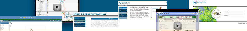
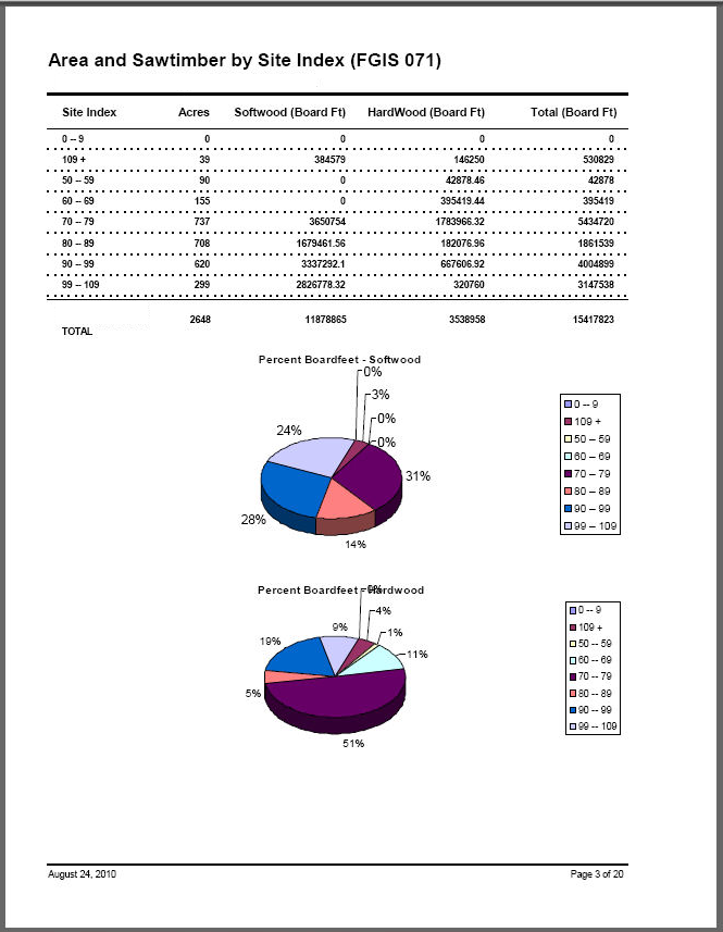
 Forestry GIS (FGIS) - ISG developed a Forestry Geographic Information System (FGIS) to support Navy personnel in the collection, storage, and management of forest stand and related data resources. This custom-built ArcGIS application provides spatial and data management tools for both office and field users, including advanced feature editing functions, tabular query capabilities, and custom reporting tools.
 -
 Environmental GIS (EGIS) - Tetra Tech developed an EGIS application that runs through the ESRI ArcGIS Desktop environment. This application provides users with varying levels of GIS knowledge with a robust tool to easily query analytical data and also offers GIS power users the ability to utilize more of the analytical tools readily available in ESRI’s GIS package.
)
)
Maps
Click a thumbnail below to view the map.
-
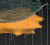 3D/4D Modeling - C-Tech EVS software was employed to model soil and groundwater contamination at various sites. The model results were integrated with ArcGIS products for mapping and visualization. Tetra Tech also developed cross-sections, volume renderings, and 3-D animation files.
 -
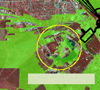 Viewshed Development - A viewshed map was developed using ArcGIS tools to determine the visual impact of a development project. The predicted viewshed map was developing using ArcGIS spatial & 3D analyst extensions, which modeled the impact of terrain and vegetation features on project visibility. Cultural resources impacted by the project were also identified in the GIS database.
)
)
)
)
)
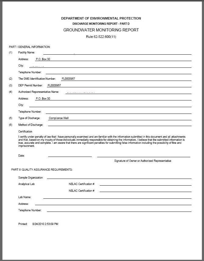
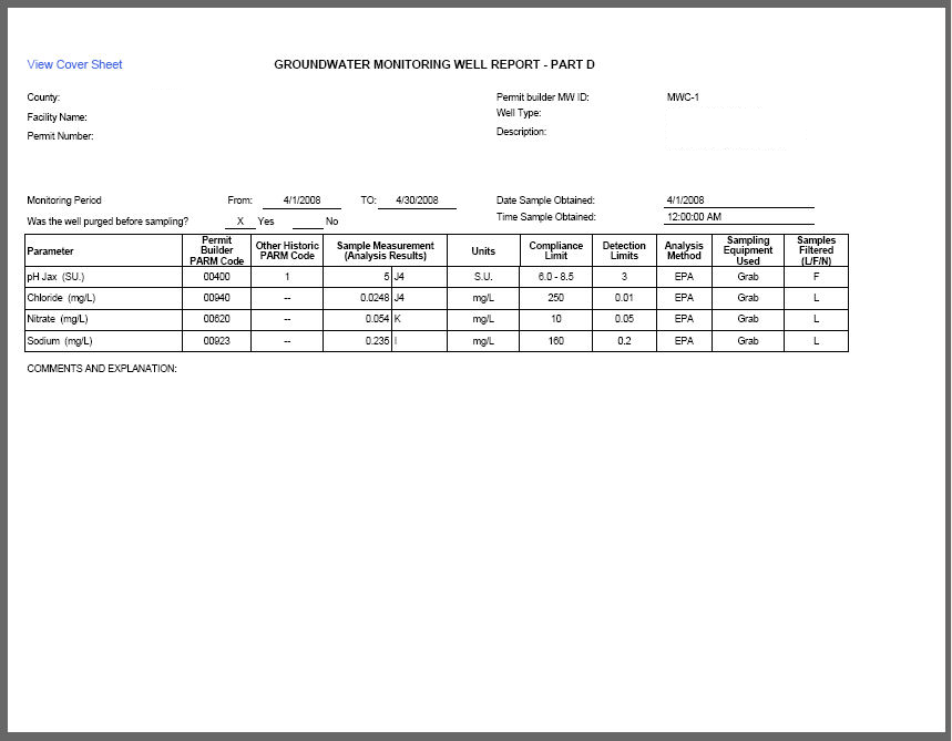
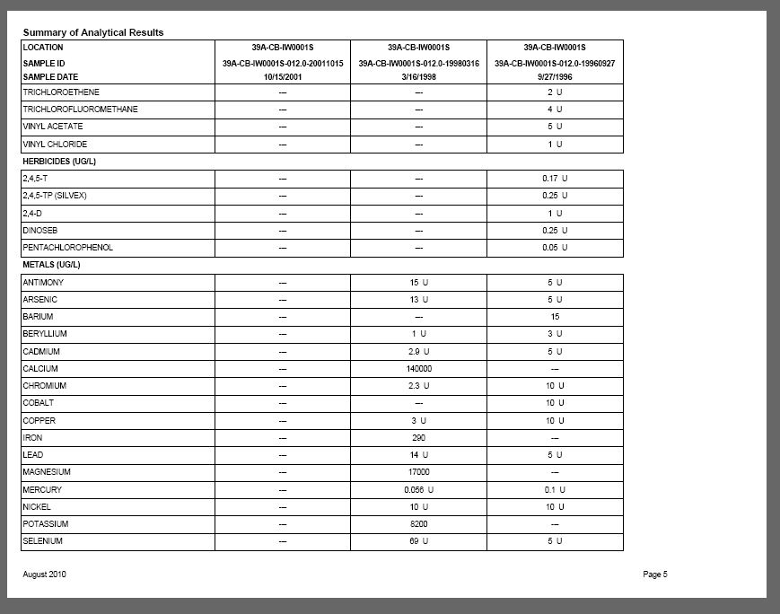
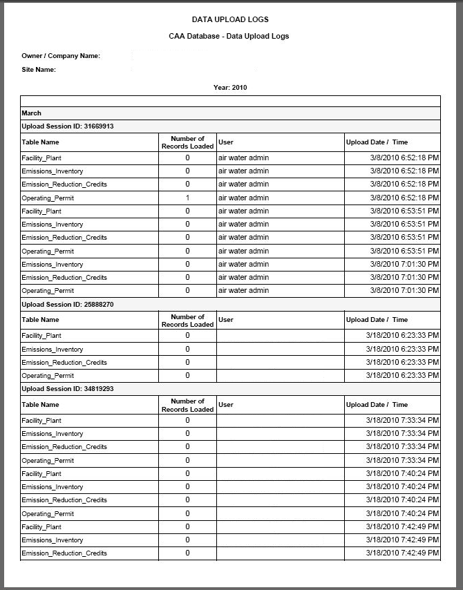
Reports
Click the thumbnail below to view a slideshow of report samples.
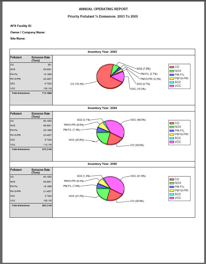
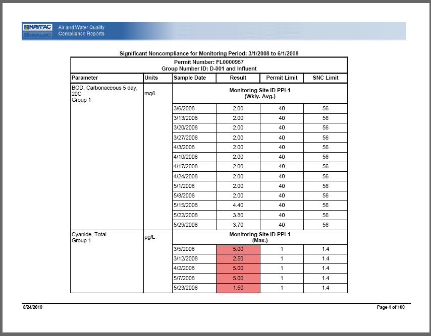
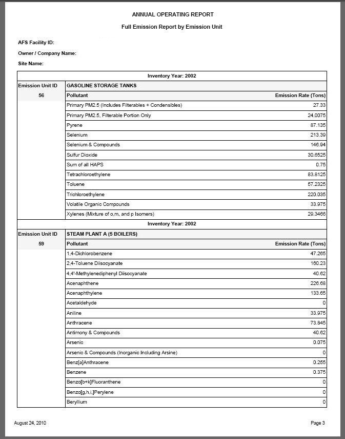
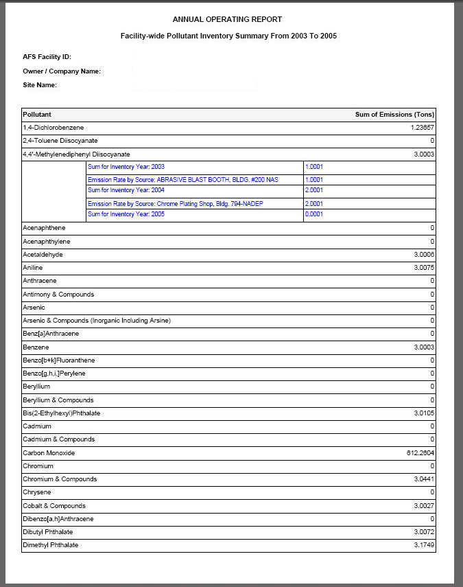
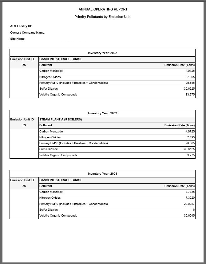
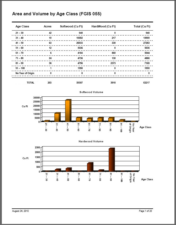
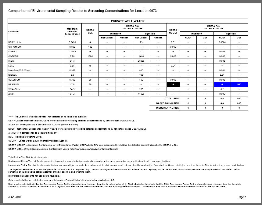
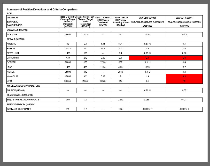
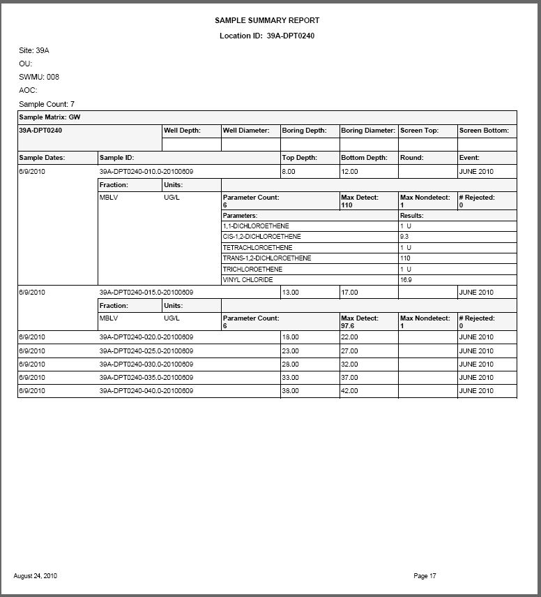
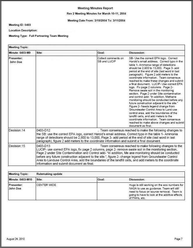
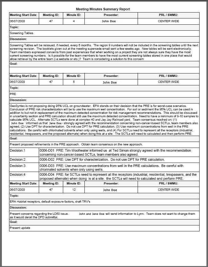
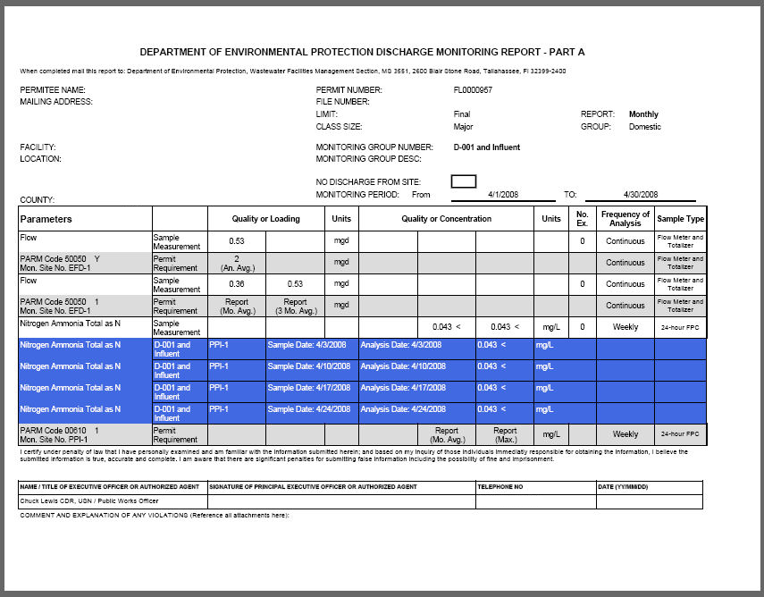
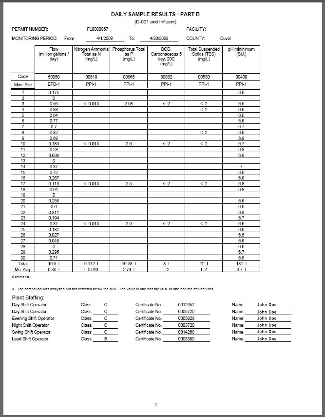
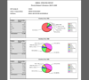 Reports - Numerous automated and electronic data reports have been developed and deployed in a variety of formats including simple summaries to more complex reports with statistical calculations and conditional formatting. Many reports have been deployed over the web and desktop environments and include interactive drill-through, search and export functionality.